LidarToolbox for Track Building is now available, making it fast and easy to work with lidar data, raster DEMs and satellite imagery when creating tracks:
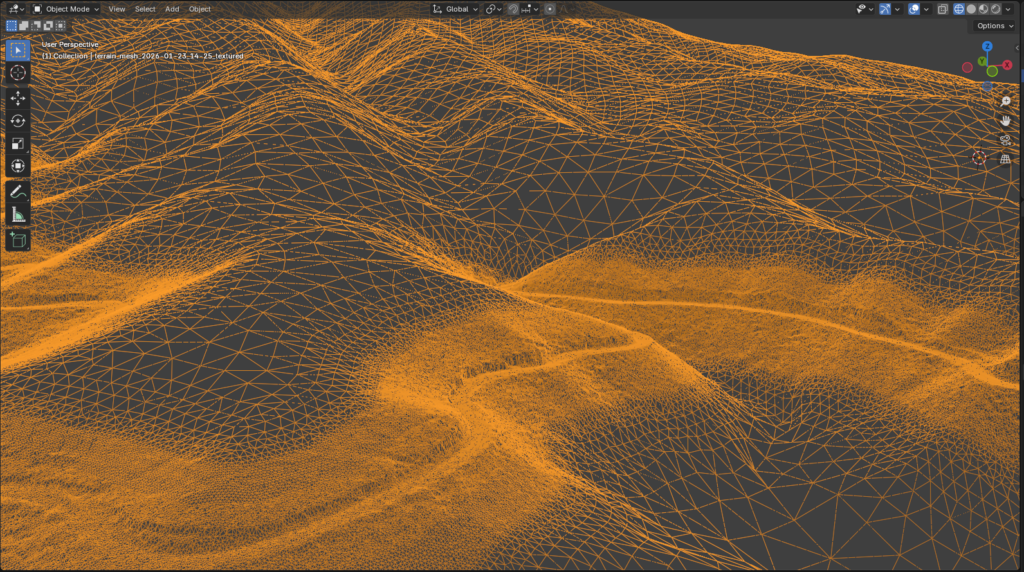
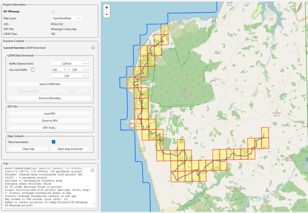
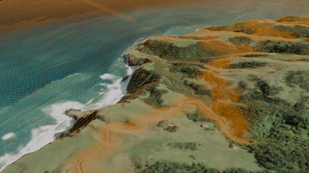
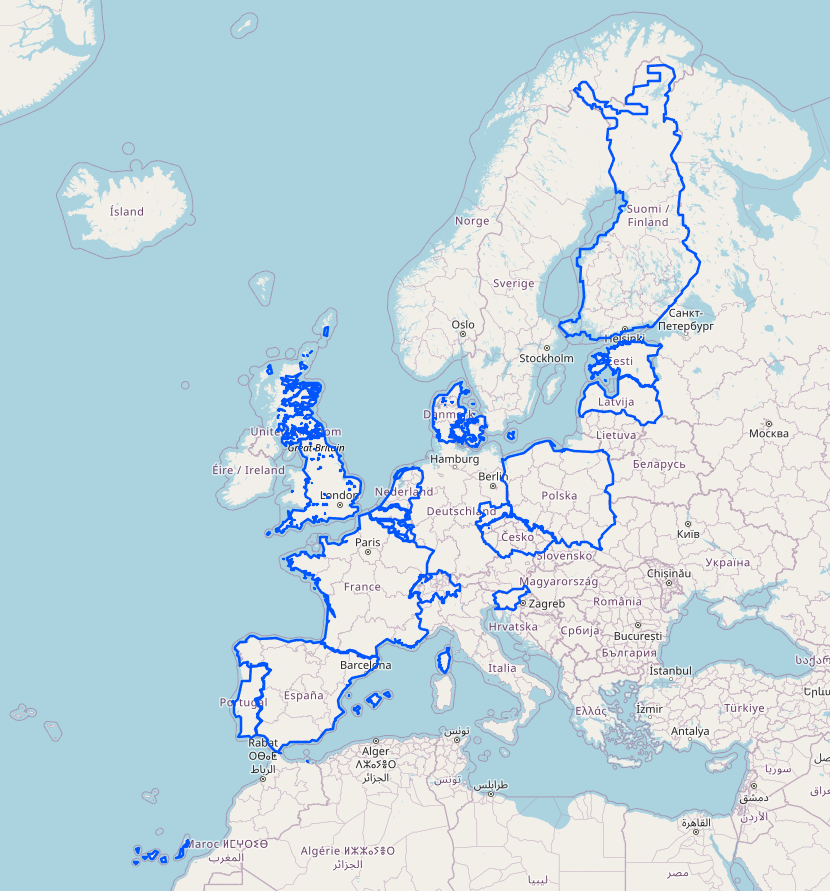
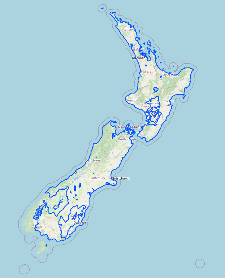
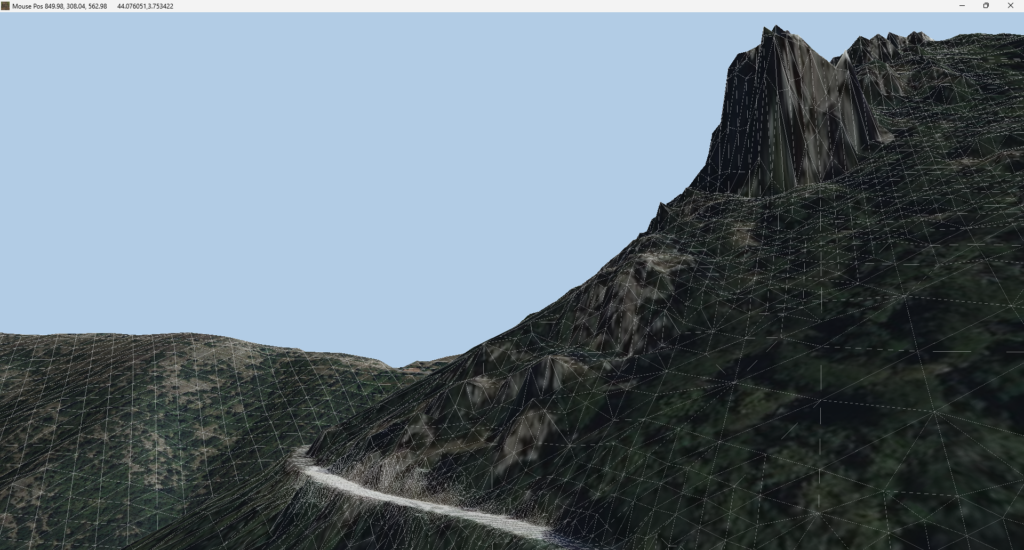
Developed by AC Rally Central and extensively tested by leading AC and RBR track modders, LidarToolbox enables the processing of massive datasets on standard Windows PCs, converting them into optimized terrain meshes within minutes. The tool simplifies the discovery and download of lidar data across a range of supported countries, and removes the hassle of coordinate systems and classifications. Regardless of data source, LidarToolbox simplifies workflows and eliminates the steep learning curve of traditional GIS software.
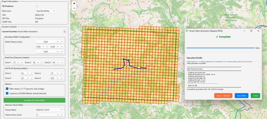
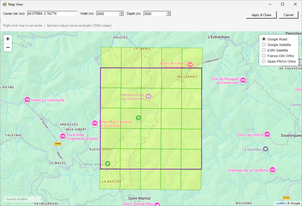
Additionally, a set of plugins for Race Track Builder has been released, enabling the use of lidar data (or raster DEM files) for highly accurate terrain modeling. Hi-res satellite imagery sources such as Google, Esri, France IGN, and Spain PNOA are also included.
The plugins are available at no additional cost with the full LidarToolbox, or can be bought separately. The toolkit will keep expanding, with new features on the way, including:
- Zone-limited meshing & texturing
- Mesh retopology based on road proximity and visibility
- Integrated lidar search and download for the United States
- A direct plugin for Blender
- A generic LidarToolbox web server capable of streaming hi-res terrain data via WebSocket or API
A full overview of LidarToolbox features and detailed instructions can be found here.